
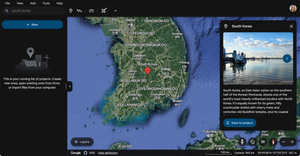
Do you use Google Earth? This interactive tool allows you to explore the world!! Any subject area can use Google Earth to connect their content to literally the world! Type in South Korea or Area 51. Use the layers to observe the latitude and longitude.
Depth of Knowledge (DOK)
DOK is the 4 levels of critical thinking. Most tools can be used at various levels of DOK but it is the lesson design that creates the critical thinking, not the tool. I am going too use ChatGPT (with prompting) to come up with some ways to use Google Earth at different DOK levels. ALWAYS BE SKEPTICAL OF DOK IN AI… it’s often wrong.
DOK 1: Recall and Reproduction
Activity: Landmark Identification
- Objective: Students will identify and label major landmarks around the world.
- Task: Using Google Earth, students drop pins on pre-selected landmarks like the Eiffel Tower, Great Wall of China, and Pyramids of Giza. They will name each landmark and provide a short description.
- Tool: Google Earth’s “Placemark” feature.
- Focus: This activity emphasizes recalling information and basic map navigation.
DOK 2: Skills and Concepts
Activity: Comparing Climates
- Objective: Students compare climates of two different locations on Earth.
- Task: Students choose two different cities on Google Earth, explore the weather and climate information, and fill out a comparison chart (e.g., temperature ranges, precipitation levels, etc.).
- Tool: Use the “Measure Distance” feature in Google Earth to calculate distances between cities and explore the climate data layer.
- Focus: This activity requires understanding and comparing concepts, such as weather patterns and geographic locations.
DOK 3: Strategic Thinking
This was labled by ChatGPT as DOK 3 but I disagree. As this activity stands they are doing a visual book report. They are making some decisions and doing a little research so this is probably DOK 2 but definitely not DOK 3. There needs to be some sort of a challenge that they have to figure out a solution to to elevate this.
DOK 2: Skills and Concepts
Activity: Route Planning for Exploration
- Objective: Students plan an exploration route based on historical expeditions.
- Task: Using Google Earth, students map out the route taken by an explorer (e.g., Marco Polo, Lewis and Clark). They will identify key stopping points and analyze the geographic challenges faced during the journey. Students will write a brief report discussing their findings.
- Tool: Use the “Path” feature in Google Earth to draw and calculate routes.
- Focus: This activity involves strategic thinking, as students must analyze geographical data and make informed decisions about the route.
DOK 2: Skills and Concepts
Activity: Exploring Human and Physical Geography
- Objective: Students explore the differences between human and physical geography by comparing two regions.
- Task: Students select one urban area (e.g., New York City) and one natural area (e.g., the Amazon Rainforest) in Google Earth. They will examine features such as population density, land use, and infrastructure in the urban area, and compare them with physical features like vegetation, water bodies, and terrain in the natural area. Students then create a Venn diagram to illustrate similarities and differences between the two regions.
- Tool: Use Google Earth’s “Layers” feature to explore and visualize data such as terrain, roads, and population.
- Focus: This activity involves interpreting and analyzing information related to human and physical geography, helping students understand how different regions of the world are shaped by both natural and human-made factors.
DOK 3: Strategic Thinking
Activity: Evaluating the Impact of Urbanization
- Objective: Students will evaluate the impact of urbanization on the environment and society in a specific region.
- Task: Students choose a rapidly growing city (e.g., Dubai, São Paulo) and use Google Earth to analyze its urban expansion over time. They will use historical imagery to compare the city’s size and structure over the past few decades. Students will then assess the environmental and social impacts of this growth, such as loss of green spaces, changes in population density, or effects on local ecosystems. Finally, they will write a report or create a presentation discussing the benefits and challenges of urbanization in their chosen city, supported by data and imagery from Google Earth.
- Tool: Utilize the “Historical Imagery” feature in Google Earth to examine changes over time, and the “Layers” feature to view additional information like population density and green spaces.
- Focus: This activity involves strategic thinking as students must analyze trends, assess impacts, and synthesize their findings into a coherent evaluation of urbanization.
DOK 3: Strategic Thinking
Activity: Analyzing Natural Disaster Risks
- Objective: Students will analyze the risk factors and potential impact of a natural disaster in a specific region.
- Task: Students select a region prone to natural disasters, such as earthquakes in California or hurricanes in the Caribbean. Using Google Earth, they will research and map key risk factors like fault lines, historical earthquake epicenters, or coastal areas vulnerable to storm surges. They will analyze how the geography of the region influences the severity and frequency of these disasters. Students then create a risk assessment report or presentation, including potential mitigation strategies (e.g., building codes, evacuation routes). They will use data and visualizations from Google Earth to support their analysis and recommendations.
- Tool: Use the “Earthquake” and “Weather” layers in Google Earth to overlay relevant data, and the “Path” tool to mark evacuation routes or fault lines.
- Focus: This activity requires strategic thinking as students must evaluate multiple risk factors, interpret geographic data, and propose informed solutions to mitigate the impact of natural disasters in the chosen region.
DOK 4: Extended Thinking
Activity: Designing a Global Awareness Project
- Objective: Students design and present a project that addresses a global issue (e.g., deforestation, climate change).
- Task: Students select a region affected by the issue on Google Earth, analyze the current situation, and propose a sustainable solution. They will create a multimedia presentation that includes maps, images, and data from Google Earth to support their proposal.
- Tool: Utilize Google Earth’s “Tour” feature to create a narrated tour that walks viewers through the region and the proposed solutions.
- Focus: This activity involves extended thinking, as it requires students to synthesize information from various sources, develop a project, and present their solution creatively.